
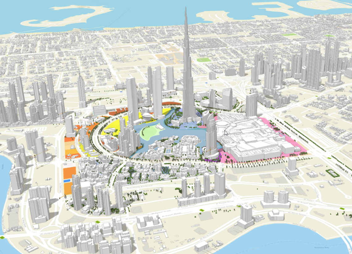
This project showcases a Smart City Digital Twin for a UAE urban area, created using ArcGIS Pro and ArcGIS CityEngine to generate detailed 3D urban models. These procedural city models are then integrated into a web-based platform built with React.js and the ArcGIS JavaScript API, enabling interactive, real-time visualization and analysis of the city's digital twin.
Key Components:
-
3D Modeling & Urban Design: ArcGIS CityEngine produces scalable, parametrically generated cityscapes from GIS data using procedural rules. WikipediaEsri
-
Geospatial Data Integration: ArcGIS Pro defines urban features—buildings, streets, trees—for the model, enriched by multiple GIS datasets. UAE Ministry of Health
-
Web Visualization & Interaction: The ArcGIS API for JavaScript delivers responsive and mobile-friendly 3D web scenes for real-time mapping and planning. Esri Proceedings
-
Deployment Platform: A React.js–based UI wraps the web viewer, offering intuitive access to the digital twin, scenario toggles, and analytic tools.
This digital twin enables city planners, stakeholders, and the public to explore, simulate, and engage with the urban environment in immersive, data-driven ways—from urban planning to operations monitoring.